

Exploring Wetland Restoration Over Time – From Above and On the Ground
Wetlands are often described as the kidneys of the land – filtering excess nutrients and contaminants, enhancing biodiversity, and quietly connecting people to nature.
When planted well, wetland and riparian species establish surprisingly quickly, transforming a landscape from something sparsely vegetated into something resilient and thriving.
Walking through the Ōtukaikino Wetland in Christchurch, surrounded by a vast array of native plantings, pīwakawaka flitting above you and pukeko families walking across the track, you could easily forget you’re just metres away from the main transport artery that is State Highway 1. A remanent of Canterbury’s marshy past, this wetland has been part of a project since 1992 to restore the area by removing the invasive willows and blackberry, and re establish it with native species.
Looking Back from Above
Keen to see how the wetland has progressed over time, I used the Canterbury Maps WebApp to explore the freely available, high resolution aerial imagery of the area. Alternating between 2024 and 2011 aerial imagery, the WebApp’s handy swipe tool makes comparing the progress tangible and interactive, gaining a new appreciation for what you see on ground when viewed from above.
We’re incredibly lucky in Canterbury to have historic aerial imagery that is not only publicly available, but georeferenced for easy use. Tools like Canterbury Maps make it straightforward to look back on, investigate past land uses, and give historical context to environmental stories.
As with many things, it takes looking back to appreciate how far you’ve come. If you’re a land manager wanting to track planting progress over time, the Canterbury Historic Aerial Imagery WebApp is well worth exploring. Often when you’ve had your head down, busy with the work on the ground, you can forget to take a step back and celebrate the progress you’ve made. Aerial imagery allows you to tell that story visually – where you started versus where you are now.
Explore the wetland all the way back to 1941 using the coordinates 172.64410944, 43.43284622:
https://apps.canterburymaps.govt.nz/CanterburyHistoricAerialImagery/
Below is a short video highlighting the difference between 2024 and 2011 wetland planting using the swipe feature in Canterbury Maps.
What That Change Looks Like on the Ground
Aerial imagery is powerful for showing change over time, but pairing it with on the ground photos helps complete the story of environmental enhancement projects.
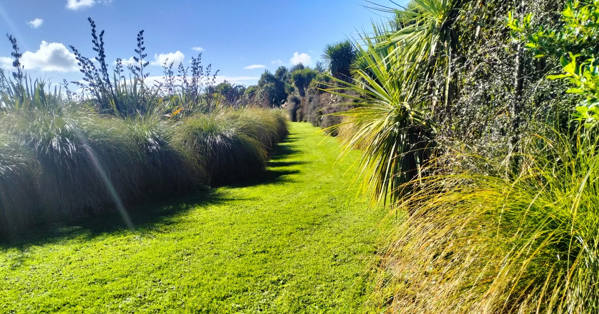
Following yesterday’s post showing the Ōtukaikino Wetland from above, these two photos show what that change looks like at ground level in March 2026. The vegetation, planted in 2013 and 2014, has established and matured quickly – a reminder of what well planned restoration can achieve in just over a decade.
Walking along the track today, the scale of that growth is impressive. What began as individual seedlings protected by cardboard collars, has now meshed together to form a diverse corridor of vegetation enclosing the grassy path. In the background, the muffled sounds of the motorway serve as a quiet reminder of the balance between human infrastructure and natural ecosystems.
Two on‑the‑ground photos, taken in March 2026, showing the current state of vegetation planted as part of the project in 2013 and 2014.
.jpg)
.jpg)
A Living Memorial
Ōtukaikino is an especially meaningful example of restoration. Its planting enhancement programme was established in conjunction with Lamb & Hayward Funeral Services as a living memorial – one tree planted for every funeral conducted. It’s a powerful illustration of how long term environmental change is often built through many small, thoughtful acts over time.
Get in touch
If you’re a land manager wanting to display your planting progress over time, get in touch to discuss how this could look for your organisation.