

GIS is one of those tools that often reveals its true value only when someone asks, “Is it possible to do XYZ in GIS?” Like many types of software, its full capabilities aren’t always obvious until a specific need arises and someone with GIS experience can weigh in on what’s possible.
When I meet with clients, our conversations usually begin by exploring their goals and challenges, and understanding what they need GIS to do for them. As with anything, you don’t know what you don’t know, so talking through the capabilities of GIS often uncovers unexpected ways it can support your work – far beyond the common perception of it just being a tool for making nice-looking maps.
Having used GIS for a multitude of purposes in the environmental space, I enjoy educating others on its capabilities beyond cartography alone. GIS is a powerful communication and management tool that can transform how you store, analyse, and report on environmental data.
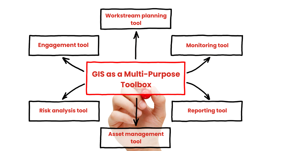
To make this easier, I’ve started framing GIS as a multi-purpose toolbox, with each tool serving a distinct function. Here’s a breakdown of the six core tools I use most often and how they might relate to your business:
1. Planning Tool
Supports spatial planning for projects, land use, infrastructure, and environmental interventions. Get efficient with your project planning and ensure everyone is on the same page by using GIS for internal coordination and external execution.
2. Monitoring Tool
Tracks changes over time – such as compliance, water quality, vegetation cover, pest eradication, or land use – using spatial and temporal data. Instead of managing environmental data in spreadsheets, georeference it and track changes visually over time.
3. Reporting Tool
Produces maps and visual outputs for stakeholders, funders, and regulatory bodies to communicate environmental conditions and track progress. These maps can be customised to suit your organisation’s specific needs and communication goals.
4. Asset Management Tool
Maintains geospatial records of infrastructure, natural assets, and operational data for efficient oversight and maintenance. This is especially useful for irrigation companies to track maintenance on pipelines, fish screens, and other infrastructure.
5. Risk Analysis Tool
Identifies and evaluates environmental and operational risks using spatial models and predictive analytics. This can be applied in farm planning or engineering contexts, with analysis of risks such as slope, flooding, nutrient runoff, and erosion.
6. Engagement Tool
Facilitates community and stakeholder engagement through interactive and static maps, dashboards, and collaborative mapping. ArcGIS, in particular, enables a high degree of interactivity and public data-capture integrations.
GIS is more than just mapping – it’s a dynamic toolbox that can adapt to a wide range of needs. Whether you're planning a pest management project, monitoring changes in water quality, or engaging with communities, GIS has the flexibility to support your goals in ways you might not expect. The key is asking the right questions and exploring what’s possible.
Curious about how GIS could support your work?
Let’s chat – I’d love to help you uncover the tools that fit your needs